Photo: Deutsches Museum
Man and Environment
Geodesy – Surveying the Earth
Where exactly is our house? How far is it to Berlin? And how big is Australia? Questions like these can be answered by geodesy, the science of surveying and dividing up the Earth’s surface.
What is Geodesy?
Geodesy is the science of surveying the Earth’s surface and representing it in the form of maps.
The term comes from Ancient Greek and means “dividing the Earth”. Geodesy originates from the need to divide up land and document its boundaries – for example to determine property ownership or to specify national borders. Large construction projects, such as roads, railway lines, canals, large bridges or tunnels, also require a precise land survey.
The history of geodesy stretches back to Ancient Egypt. Here, the occupation of a land surveyor, known as a geodesist, became one of the most important jobs in the country for a few weeks each year after the flooding of the River Nile.
The possibility of exploring the Earth from a distance – initially with aerial photographs, and later on using satellites – brought significant changes to the discipline in the 20th century. The development of the computer also had a major impact on geodesy.
1.20mThe diameter of the satellite dish for the weather satellite receiving station.
approx. 10,000The number of valuable historic maps in the archive of the Deutsches Museum.
1568The year in which Philipp Apian’s maps of Bavaria were created.
Exhibition Themes
Philipp Apian’s maps of Bavaria, 1568. Photo: Deutsches Museum | Christian Illing
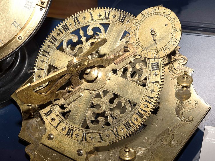
Land Surveying and Geodetic Instruments
In addition to a large, modern topographic map of Bavaria, the exhibition also features the Bavarian map produced by Philipp Apian in 1568. This new form of representation – “geographical space” presented as a map – replaced the itinerary descriptions that had been common up to that time and marked the beginning of a new form of land surveying in the early modern era. For a long time, Apian’s map remained the best overall representation of Bavaria available. It was not until the beginning of the 19th century that a much better series of maps was created when the newly formed Kingdom of Bavaria was surveyed.
Some geodetic instruments from the museum’s extensive collection are presented as examples. They illustrate the most important tasks when measuring: the determination of distances, angles and altitudes in the terrain.
Stereoplanigraph C8 contour plotter, 1955. Photo: Deutsches Museum | Christian Illing
Photogrammetry
Due to its great significance for geodesy, the subject of photogrammetry is presented in a separate section. Photogrammetric pictures can be taken either from a position on the Earth (terrestrial photogrammetry) or from the air (aerophotogrammetry). Terrestrial photogrammetry plays a particularly important role for engineering surveys and in high mountain regions. Aerial photographs, on the other hand, provide an important basis for topographic surveys with a number of uses. The exhibition briefly addresses satellite geodesy, too.
Display case containing exhibits relating to the development of fiducial points networks. Photo: Deutsches Museum | Christian Illing
Tasks of Geodesy
The following area of the exhibition looks at the individual disciplines of geodesy. The measurement of the Earth (including gravimetry, the measurement of the local gravitational field) serves to determine the precise shape of our planet. The development of fiducial points – networks of selected, precisely surveyed and marked points in the terrain – forms a basis for all the other surveying tasks. Then there are explanations and examples of applications for topography, cadastral surveys and engineering surveys.
Two of our historic globes in the Cartography exhibition area. Photo: Deutsches Museum | Christian Illing
Cartography
Surveying work leads to the creation of maps. The final area of the exhibition features a part of our collection of historic maps and impressive globes from various eras. A relief of Mount Everest with the associated map illustrates how terrain on the map is represented. Other exhibition themes include the various methods of projection – in other words, ways of presenting the curved surface of the Earth on a flat map – as well as the development of map printing, ranging from woodcuts to a digital map generated on a computer.
The weather satellites receiving station in the Geodesy exhibition. Photo: Deutsches Museum | Christian Illing
Receiving Station for Weather Satellites
The weather station receives digital image signals from the European weather satellites METOP and METEOSAT, as well as the American NOAA satellites. A 1.20m satellite dish guides the satellite signals to a special receiver PC, which uses them to create images of the Earth’s surface.
The METEOSAT, which is 36,000km above the Gulf of Guinea, provides images of the visible surface of the Earth every 15 minutes, illustrating the weather patterns of the past 24 hours as a continuous film at the station.
The European intergovernmental organisation EUMETSAT has granted the Deutsches Museum a licence to present the data, which is normally encrypted.
Regular demonstrations take place at the weather station as part of our daily programme.
After the refurbishment has been completed, visitors will be able to see the weather station in the new Astronautics exhibition.
Inside the Geodesy Exhibition
Virtual Tour
Discover the exhibition in 360°: click the mouse or touch the screen to look around in any direction. The virtual tour also includes text, films and audio information for many of the exhibits.
Virtual Tour through the Geodesy Exhibition
Facts
- 390 sqm exhibition area
- approx. 200 exhibits and interactive activity stations
- An exhibition at the Deutsches Museum since 1906, redesigned in 1993


Any Questions?
![Schwarzweiß-Porträt einer Person mit dichtem, kinnlangem gewelltem dunklem Haar; Gesicht anonymisiert durch graues Rechteck; sie trägt einen locker gewickelten, dunklen Schal und dunkle Oberbekleidung, neutraler Hintergrund.]()
Dr. Daniela Schneevoigt
Curator
Department of Physics, Geophysics, Geodesy, Weights and MeasuresMuseumsinsel 1
80306 Munich
Fax +49 89 2179 99350
Email d.schneevoigt@deutsches-museum.de


![[Translate to English:] Das System Erde dargestellt durch verschiedene Globen.](/assets/_processed_/a/8/csm_Ausstellung_Umwelt_CD_L_7596_354_ebff66bd31.jpg)